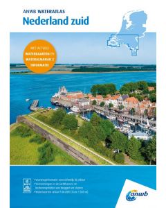
ANWB Wateratlas Nederland Zuid

- FREE Delivery to UK - Spend over £75
- FREE Delivery to Europe - Spend over £150
- Worldwide Delivery Available
Water maps for a large area in a handy atlas combined with the most important data from the ANWB Water Almanac part 2. Indispensable for pleasure and commercial shipping on Dutch inland waterways.
With information about marinas, shipyards, locks, tunnels, bridges, beacons, soundings, warning signs and passage dimensions.
Product Details
Part Number: ANWBZUID
Scale: 1:50000
ISBN: 9789018054083
Publisher: ANWB
Edition: 2025
Printed and corrected to: edition date
Format: Spiralbound
Language: Dutch
The ANWB Water Maps are a household name in water sports and inland shipping. No skipper goes out on the water without the help of this reliable cartographic and nautical information from the ANWB. The completely new ANWB Water Atlases continue this tradition. The new ANWB Water Atlas Netherlands is the replacement for the ANWB Water Maps. The atlas consists of three parts that together show the whole of the Netherlands. Each atlas consists of Water Maps on a scale of 1: 50,000 bundled in a handy atlas combined with the most important data from the ANWB Water Almanac part 2. The ANWB Water Atlas is therefore the ideal reference work for the area in question. The atlas compactly bundles the well-known ANWB Water Maps and the information from the Water Almanac part 2. Navigate effortlessly over lakes and rivers with the integrated water maps and in no time you will find information about marinas and operating times of bridges and locks.
In the ANWB Water Atlas you will find all the information you need to sail on Dutch inland waterways, such as the navigability of waterways, the water level and depth, the buoys, the fairways, obstacles and landmarks. But also the facilities, such as clubs, trailer ramps, boarding places, anchorages and even sewage stations and diving locations. The water map provides extensive information about, for example, the permitted maximum sailing speeds and maximum draft for pleasure craft on the waterways. Of course, this atlas offers a clear overview of the bridges, locks and marinas. Suitable for canoes, kayaks, yachts, sailboats and motorboats.
The Water Atlas Netherlands South contains the following information:
- Waterway information
- Marina facilities
- Operating times of bridges and locks
- Water maps (scale 1:50,000, 1 cm = 500 m)
- With detailed maps of the most important ports
- Clear information about marinas, moorings, buoyage, depth of the waterway, fuel points, maximum speed, bridges and locks
- Information about the Standing Mast Route through the South of the Netherlands (South Holland and Zeeland Delta)
The ANWB Water Atlas is a sailing map and water almanac in one. Handy format and easy to use. Bound with a spiral so that the atlas easily remains open. The Water Maps show information about marinas, wharves, locks, tunnels, bridges, beacons, gauges, warning signs and passage dimensions.
- Reliable and detailed nautical information on the map
- Extensive legend and very user-friendly
- Logical layout of sailing areas
- With inset maps of the most important ports and places in a sailing area
- Clear map view
- Completely renewed surface
- Practical atlas, ring bound
The ANWB Water Atlas provides nautical maps for the whole of the Netherlands in three parts. There is a part for the North of the Netherlands, the Middle of the Netherlands and the South of the Netherlands. The ANWB Water Atlas Netherlands South provides nautical maps and nautical information for the waterways and waters in Zeeland, North Brabant and Limburg. Furthermore, this atlas covers part of the River area of South Holland, Utrecht, Brabant and Gelderland including the South Holland Delta and the adjacent coastal waters.
The ANWB Water Atlas South replaces the ANWB Water Maps 13 West Brabant, 14 Zeeuwse Delta, 15 Biesbosch, 16 Noord-Brabant and Noord Limburg, 17 Limburgse Maas Zuid. In addition, this atlas overlaps with parts of the ANWB Water Maps 8 Major Rivers, 12 Hollandse Delta and a part of Water Map 19 Dutch Coast. This Water Atlas contains the most important information for the South of the Netherlands from the ANWB Water Almanac part 2.