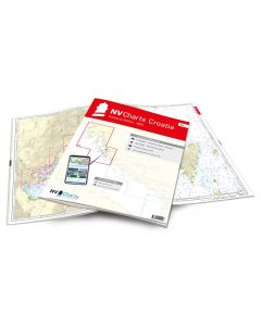
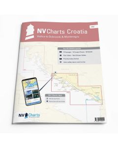
NV Atlas Croatia HR 2: Vodice to Dubrovnik & Montenegro
- FREE Delivery to UK - Spend over £75
- FREE Delivery to Europe - Spend over £150
- Worldwide Delivery Available
This atlas contains a download code for all charts in this area to be used with the nv chart app. The app is compatible with Apple: iOS/MacOSX, Android & Windows: 7/8/10.
Product Details
Part Number: YOT0006HR2
Scale: 1:1(Various)
ISBN: 9783945902455
Publisher: NV Charts
Edition: 2024
Printed and corrected to: March 2024
Format: Combipack - Paper / Download and app
Language: English
MPN: 9982
Croatia is internationally very popular for tourists and water sports enthusiasts, this is due, among other things, to its numerous ports, the breathtaking nature and the turquoise-blue water. The south of Croatia in particular impresses with its charming landscape and the varied coastline with small fishing villages, but also pulsating cities such as Split or Dubrovnik. When it comes to berths, there is also something for every taste at the various harbours and anchorages. There are small jetties or luxurious marinas with an all-inclusive package such as Marina Dalmacija on the east coast of the Adriatic in Sukošan or the award-winning Marina Frapa in Rogoznica. The quieter anchorages can be found quickly and easily using symbols on the chart and will make your trip unforgettable. With this combination pack you are optimally equipped for your trip on the Croatian coast!
Thanks to the clear structure, the skipper can quickly find approaches, harbours and anchorages and is informed of important navigational details that also appear in the NV Charts app. The chart series impresses with its optimal scales and balanced sheet cuts.
NV Atlas chart format
NV Charts nautical charts are available in an outstandingly practical, handy atlas booklet format and thus offer many advantages over formats from other manufacturers. The nautical chart series have been designed by nautical experts and passionate water sports enthusiasts with the needs of recreational boating in mind.
The NV Atlas has a very flat staple binding in the middle, so that the course triangle can also be used there without any problems. This innovative development makes it possible to look up charts quickly and always have them in the best possible order at the same scale. The NV Atlas is delivered in a plastic cover protected against splash water. This modern nautical chart format is very popular on sailing boats as well as on motor yachts and is the preferred choice of many of our customers.
NV Charts navigation app
All NV Charts nautical charts also include an access code to the digital nautical charts in the NV Charts app and can thus be easily downloaded. The charts are valid for 365 days from activation and can be used for offline navigation with the NV Charts app on iOS, Android, PC and Mac or also in the web browser.
The NV Charts app is the ideal addition on mobile devices. With the app, you can already plan a detailed route at home and thus prepare for your journey in the best possible way in conjunction with the paper chart. The app is intuitive to use and, thanks to an identical map image, you can orientate yourself on paper and digitally in a matter of seconds. The most up-to-date information is essential to navigate safely on the water with your sailboat or motorboat.
With the NV Charts app, you now have the opportunity to become part of the chart community. You can mark harbours, anchorages and navigation warnings on the digital nautical chart and also add interesting places beyond navigation, such as restaurants, with pictures and comments and share your experiences with other users. In addition, the NV Charts app offers an automatic routing function, search and all navigation functions for GPS navigation with your phone or tablet. More information at: nvcharts.com/app
More PC navigation apps: NV Verlag / NV Charts nautical charts can also be used in many other nv.digital compatible PC navigation programs such as NV Chart Navigator or Open CPN.
Containing charts and scales
Passage Charts
C1 Adriatic Sea 1: 1.750000 C2 Blitvenica to Mljet 1: 350000 C3 Mljet to Albania 1: 350000
Coastal Charts
C4 Vodice to Rogoznica 1: 100000 C5 Rogoznica to Split 1: 100000 C6 Split to Hvarski Kanal 1: 100000 C7 Vis - Svetac 1: 100.000 C8 Hvar West 1: 100.000 C9 Neretvanski Kanal 1: 100.000 C10 Lastovski Kanal 1: 100.000 C11 Lastovski & Mljetski Kanal 1: 100.000 C12 Mljetski Kanal to Dubrovnik 1: 100.000 C13 Dubrovnik to Rt. Oštra 1: 100.000 C14 Rt. Oštra to Mr. Katici 1: 100.000 C15 Mr. Katici to Rt. Mentra 1: 100.000
Details
16 Šibenik Approach 1:50.000 17A Split 1:30.000 17B Trogirski Zaljev 1:30.000 18A Split - Zenta 1:6.000 18B Maslinica 1:30.000 18C Splitska Vrata 1:30.000 18D Viška Luka 1:20.000 19A Vrboska 1:30.000 19B Pakleni Kanal 1:30.000 20A Ploce 1:15.000 20B Makarska 1:10.000 20C Luka Slano 1:15.000 20D Šipanska Luka 1:15.000 21 Stonski Kanal 1:20.000 22A Otok Korcula 1:30.000 22B Otok Lastovo 1:30.000 22C Dubrovnik - Lokrum 1:15.000 23 Dubrovnik 1:15.000 24A Rijeka Dubrovacka 1:10:000 24B Tivat 1:10.000 24C Šibenik 1:20.000 25A Cavtat 1:15.000 25B Barsko Sidrište 1:25.000 Legend - General Notes p.26

